
Simrad NSS 4 Chartplotter and Fishfinder
4.6Editor score
Eight-core Qualcomm processor
Dual-channel CHIRP sonar
SolarMAX HD touchscreen display
Extensive vessel integration options
Chartplotters for offshore fishing combine navigational mapping with fish-finding sonar, route planning, weather awareness, and vessel integration. The most useful model for a particular boat is not simply the one with the largest screen or widest scanning range; it is the system that provides clear information under sun glare, rough water, and changing offshore conditions.
This guide compares ten chartplotter packages using the supplied specifications, ratings, display information, sonar capabilities, mapping options, connectivity, and installation considerations. The list includes premium all-in-one systems, mid-size touchscreen units, sonar bundles, and more compact options for anglers working smaller boats or tighter helm layouts.
Each review explains the product's strongest offshore capabilities, practical limitations, and likely buyer profile. Ratings and specifications reflect the current product information, while availability, bundle contents, chart options, and pricing can change. Always verify the latest configuration and compatibility before making a final purchase.
4.6Editor score

4.7Editor score

4.5Editor score
As an Amazon Associate we earn from qualifying purchases.
The comparison below highlights display size, sonar configuration, mapping, connectivity, and major integration features. It helps distinguish purpose-built offshore performance systems from smaller chartplotters, entry-level helm units, and bundles that include specialized scanning sonar.




The Humminbird XPLORE Series combines a 10-inch display, advanced imaging sonar, detailed navigation, and extensive network connections. Its 4.7 rating reflects a well-rounded package, while the standout feature is MEGA Side Imaging+, which extends 200 feet to each side of the boat. That reach can reveal offshore structure, drop-offs, schools, and debris without requiring the angler to travel directly over every target.
We may earn a commission when you buy through this link, at no additional cost to you.
Fish-finding performance is supported by MEGA Down Imaging+, providing 200 feet of depth coverage, and Dual Spectrum CHIRP sonar for locating fish and interpreting structure. The combination is particularly useful when an angler needs both a broad horizontal view and a detailed look below the boat. The touchscreen interface also supports keypad operation, which can be useful when glare, spray, or rough conditions make precise touch selection more difficult.
Navigation is another strength. The enhanced Humminbird Basemap covers more than 10,000 lakes and coastal waters, with terrain, markers, hazards, and marina information. AutoChart Live can create maps of depth contours, bottom hardness, and vegetation in real time, with eight hours of built-in recording time. A LakeMaster and CoastMaster VX card for United States and Canadian regions is included according to the supplied information.
The important trade-off is bundle configuration: this is a control-head-only model without a transducer. A buyer who already owns a compatible Humminbird sonar setup may find that advantageous, but a new installation will need the appropriate transducer and mounting hardware. This XPLORE configuration is recommended for offshore anglers who value wide imaging, flexible control, charting, and integration with other marine electronics.
It is our top Editor's Choice because it balances navigation, sonar range, real-time mapping, and helm control unusually well. The missing transducer makes it less convenient as an all-in-one purchase, but for a boat with existing equipment—or one being carefully assembled—it delivers the most versatile offshore feature set in this list.
MEGA Side Imaging+ reaches 200 feet on each side, helping offshore anglers inspect reef edges, weed lines, drop-offs, and bait concentrations. It offers a more useful picture of the surrounding habitat than conventional forward-looking sonar alone.
AutoChart Live records depth contours, bottom hardness, and vegetation while the boat moves. Eight hours of built-in recording time gives offshore anglers a practical way to develop a personal record of unfamiliar water.
We may earn a commission when you buy through this link, at no additional cost to you.
The Garmin ECHOMAP UHD2 94sv is a particularly complete 9-inch coastal chartplotter because the GT56-TM transducer is included. With a 4.7 rating, it stands out for a bright, sunlight-readable touchscreen, improved detail, clarity, and viewing angle. The supplied Garmin Navionics+ U.S. Coastal charts make it easier to begin offshore navigation without treating mapping as a separate add-on.
We may earn a commission when you buy through this link, at no additional cost to you.
Sonar coverage comes from Garmin traditional, ClearVü, and SideVü scanning sonar, allowing the display to present different views of fish and bottom structure. Traditional sonar gives a dependable general-purpose view, while the scanning frequencies add detail that can help distinguish structure and suspended targets. Because the GT56-TM is part of the listed package, the buyer does not need to choose a separate transducer for the basic sonar installation.
Wireless connectivity expands the system beyond the helm. Sonar, waypoints, and routes can be shared with another ECHOMAP UHD2 chartplotter. The unit also connects wirelessly to a Garmin Force trolling motor, allowing offshore anglers to create and follow routes, navigate to waypoints, control speed, and check battery status from the chartplotter.
The main compromise is screen size. Nine inches remains highly usable for offshore operation, but it offers less visual room than the 10-, 12-, and larger options in this guide. Some wireless functions also depend on compatible devices and network equipment. Even so, this package is more immediately useful for a new installation than options that omit the transducer.
Choose the 94sv when you want a proven, balanced marine electronics platform with coastal charts, several sonar modes, wireless sharing, and trolling motor control in one package. It is a particularly strong fit for offshore anglers who value a straightforward, complete setup over the very largest helm display.
The included GT56-TM transducer supports traditional, ClearVü, and SideVü scanning sonar, reducing the need for a separate initial transducer purchase. It provides multiple ways to interpret structure and fish around offshore wrecks, reefs, and drop-offs.
Wireless integration with a Garmin Force trolling motor lets the display handle route following, waypoint navigation, speed control, and battery monitoring. This can reduce helm workload when heading to or working a distant offshore target.
We may earn a commission when you buy through this link, at no additional cost to you.
The Simrad NSS 4 is an ambitious premium chartplotter and fishfinder package rated 4.6. It combines navigation, sonar, app support, and vessel integration in a sleek helm system. Its most distinctive hardware feature is a Qualcomm 8-core processor, intended to make transitions and updates smoother than those found in less powerful systems.
We may earn a commission when you buy through this link, at no additional cost to you.
Control is unusually flexible for a modern display. A touchscreen, rotary dial, and keypad all work together, allowing the angler to select the interaction style that feels best under changing conditions. The interface also supports pinned applications and customizable screens, useful for arranging navigation, sonar, engine data, and other frequently used tools around a personal workflow.
Fish-finding capabilities include built-in dual-channel CHIRP sonar and Active Imaging HD support. Navigation supports the latest C-MAP DISCOVER X or REVEAL X charts, along with CMOR Mapping and Standard Mapping. The system also integrates with the wider Simrad suite and third-party technologies such as Mercury SmartCraft Connect and SiriusXM WM-4.
There are trade-offs. This is a premium-oriented system, and the FISHCAST feature that delivers offshore fishing hotspots requires a subscription available through C-MAP. Buyers should also account for the specific transducer, radar, and other accessories needed to build the complete system. Those considerations make the package most convincing for a serious offshore helm that will grow over time.
We recommend the NSS 4 for experienced boat owners who want fast processing, flexible controls, advanced sonar, and extensive network integration in a single premium platform. Its capabilities justify the Best Premium designation for anglers who view chartplotter selection as a long-term electronics decision rather than a simple display purchase.
The Qualcomm eight-core processor is designed to support fast updates and smoother transitions. Combined with touchscreen, keypad, and rotary-dial input, it gives offshore anglers several ways to work quickly without committing to one control style.
Support for the Simrad ecosystem, Mercury SmartCraft Connect, SiriusXM WM-4, radar, and additional mapping systems makes NSS 4 a strong centerpiece for a complex helm. The goal is a connected system rather than an isolated chartplotter.
We may earn a commission when you buy through this link, at no additional cost to you.
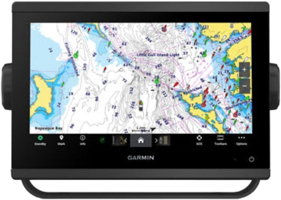
The Garmin ECHOMAP Ultra 2 126sv earns a 4.9 rating, the highest in this comparison, and offers a large 12-inch chartplotter for offshore navigation. Its 126sv designation identifies a capable premium-series unit, while Garmin Navionics+ charts are included. The large display is especially useful when comparing mapping, sonar, routes, and vessel information across a broad helm.
We may earn a commission when you buy through this link, at no additional cost to you.
Multi-band GPS is one of the most relevant offshore features. It is intended to improve position accuracy, which can help when navigating among reefs, channels, waypoints, and changing structure. Wireless networking allows the display to share sonar, waypoints, and routes with compatible Garmin equipment, supporting a multi-screen helm setup.
The unit can also capture screen recordings of fishing activity, a useful way to document catches or interesting sonar passages. That feature adds a different kind of value from raw navigation: it preserves moments that are otherwise difficult to recreate from memory or notes.
The clearest limitation is that the GT56UHD-TM transducer is not included and must be purchased separately. The 12-inch display also demands adequate console space, and offshore anglers should consider mounting visibility, glare, power routing, and network requirements. These are acceptable for a larger boat or premium console, but less convenient for a compact center-console.
This is a strong recommendation for offshore anglers who prioritize chart detail, accurate positioning, large-screen clarity, and a connected Garmin helm. The separate transducer adds an extra configuration step, yet the high rating and premium display make the 126sv a compelling centerpiece when the boat can accommodate it.
Multi-band GPS is designed to improve position accuracy in challenging conditions. That precision matters when an angler is following narrow routes or trying to return to a specific offshore structure.
Screen-recording support helps preserve catch moments and memorable sonar encounters. Wireless sharing of sonar, routes, and waypoints also supports a more integrated multi-device helm.
We may earn a commission when you buy through this link, at no additional cost to you.
The Simrad GO Chartplotter is a 4.4-rated multifunction display aimed at sportboats, center-consoles, and smaller cruisers. The included configuration provides a practical balance of charting, fishfinding, and connectivity without requiring every offshore helm to begin with the largest possible system. Its GO9 designation indicates a nine-inch-class unit built for versatile multifunction use.
We may earn a commission when you buy through this link, at no additional cost to you.
The included HDI transducer supports 83/200 kHz frequencies, CHIRP sonar, and DownScan Imaging. Those tools help identify bottom structure and fish targets, while radar capability can be added when an offshore boat needs better awareness of traffic or weather systems. The supplied C-MAP Discover card adds vector charts, custom depth shading, tides and currents, high-resolution bathymetric contours, and broad coverage in the United States and Canada.
Built-in GPS, Wi-Fi, and NMEA 2000 support make this more than a standalone fish finder. The display can mirror to a phone or tablet, allowing charts, radar, and other functions to be viewed from elsewhere aboard. NMEA 2000 also creates a path to broader integration with compatible vessel systems.
The limitations center on scale. A GO series display is not positioned in the same performance tier as the NSS 4 or larger premium Garmin units, and advanced features may depend on added transducers, radar, sensors, or networking. A buyer who expects future expansion should plan the installation rather than merely buying the display in isolation.
This Simrad GO package is a sensible choice for offshore and nearshore anglers who want charting, CHIRP, DownScan, radar expansion, and device connectivity in a flexible platform. It is especially attractive where a smaller boat needs more capability than a basic chartplotter without requiring a full premium helm architecture.
C-MAP Discover includes vector charts, custom depth shading, tides and currents, and bathymetric contours. Those details are useful for interpreting rapidly changing water and finding structure along offshore routes.
Radar support, smartphone mirroring, Wi-Fi, and NMEA 2000 let the GO system grow with the boat. It can serve as an entry point for a broader helm without locking the owner into a single display-only setup.
We may earn a commission when you buy through this link, at no additional cost to you.
The ECHOMAP Ultra 2 10-inch LiveScope Plus Bundle is a specialized 4.4-rated system for offshore anglers who want live-sonar information in a larger display package. Its defining feature is the inclusion of LiveScope Plus, while the chartplotter provides a bright, sunlight-readable touchscreen and vivid, high-contrast color palettes for interpreting structure and targets.
We may earn a commission when you buy through this link, at no additional cost to you.
Garmin Navionics+ mapping is built in, and the bundle includes one year of subscription-based daily updates. That gives the system a stronger mapping foundation than a basic chartplotter. Wireless information sharing with other Ultra 2 or UHD2 fish finder and chartplotter units also supports a multi-display installation.
LiveScope Plus adds a different sonar perspective from conventional down, side, or forward-looking views. That makes it useful when an angler wants to watch activity around the boat in real time, particularly around structure or near the water column. The larger 10-inch screen provides room to interpret that information alongside navigation data.
Because this is a bundle, buyers should confirm exactly which display, mount, cabling, and networking components are included before comparison shopping. It is also a more specialized purchase than a general chartplotter with a standard transducer. Those factors matter because LiveScope is most useful to anglers who understand how they will use it rather than those simply seeking the broadest possible sonar feature list.
This package suits the offshore angler who specifically values live sonar and a bright 10-inch interface. It is less compelling for a general-purpose helm buyer who only needs conventional scanning sonar, but for a fishing-focused installation it delivers a focused combination of real-time imaging, mapping, and wireless sharing.
LiveScope Plus provides a real-time view that can complement standard sonar views. The 10-inch high-contrast screen gives an angler room to watch the water column and structure while retaining navigation access.
Garmin Navionics+ mapping and one year of daily updates provide a strong starting point for offshore route planning. Buyers should verify the renewal terms before installation if continuous updates are important.
We may earn a commission when you buy through this link, at no additional cost to you.
The Garmin GPSMAP 943xsv SideVü is a 4.7-rated, high-definition sonar platform with a strong offshore pedigree. Its listed features include ultra-high-definition scanning sonar, Panoptix sonar support, preloaded mapping, and improved display optics. The system is positioned as a capable chartplotter and fish finder for anglers who value established marine-electronics features.
We may earn a commission when you buy through this link, at no additional cost to you.
Ultra-high-definition scanning sonar provides greater detail than conventional sonar views, helping anglers identify subtle structure and separate fish-holding areas. Panoptix support expands the potential range of viewing angles and target interpretation when the required equipment is added. This makes the unit attractive for offshore anglers who want more than a basic down-looking fish finder.
Preloaded mapping removes one step from initial setup, while improved display optics help preserve visibility in bright conditions. The overall platform is designed to deliver both navigation and sonar performance in a conventional chartplotter format, which can simplify installation on boats already familiar with Garmin equipment.
As a product generation, the 943xsv may appeal to buyers seeking a proven configuration, but newer models can offer more advanced processors, larger screens, newer sonar ecosystems, or more sophisticated integration. It is important to verify the transducer and optional sonar hardware included with the specific listing rather than assuming every available feature comes as a complete package.
The GPSMAP 943xsv is a strong choice for offshore anglers who prioritize detailed sonar, Panoptix capability, and a preloaded chart foundation. It is particularly compelling for a boat that values familiar Garmin controls and a proven marine platform over the newest premium architecture.
Ultra-high-definition scanning sonar is designed to reveal more detail in structure and target returns. That makes it useful when offshore fishing requires a more nuanced view than a basic depth or fish-arch display.
Panoptix sonar support allows the system to expand beyond a single conventional viewing perspective. Owners should plan compatible hardware, mounting, and network connections if those advanced views are central to the installation.
We may earn a commission when you buy through this link, at no additional cost to you.
The Humminbird Helix 5 Chirp GPS G3 is a compact 4.5-rated fish finder with a five-inch display, Dual Spectrum CHIRP sonar, GPS navigation, and AutoChart Live. It offers fewer headline features than the large premium units, but it delivers the core tools many offshore anglers need in a space-efficient package for smaller center-consoles, boats, and tighter helm layouts.
We may earn a commission when you buy through this link, at no additional cost to you.
Dual Spectrum CHIRP provides Wide Mode for broad coverage and Narrow Mode for more detailed scanning. The Low-Q transducer supports precise two-dimensional target separation, which can help anglers identify individual fish and distinguish them from structure. AutoChart Live builds maps of depth contours, bottom hardness, and vegetation while the boat moves, with eight hours of built-in recording time.
The Humminbird Basemap covers more than 10,000 lakes and the continental United States coastline. Compatibility with premium LakeMaster, CoastMaster, and Navionics charts gives owners a path to expanded mapping. AutoChart Zero Line SD cards can also expand mapping capacity beyond the built-in recording allowance.
The biggest limitation is display size. A five-inch screen cannot show as much information at once as a nine-, 10-, or 12-inch chartplotter, and the Helix 5 is less oriented toward advanced multi-device networks. Softkey controls are nevertheless straightforward and can be reliable in spray or rough weather, which is useful for an angler who prefers buttons to a touchscreen.
This Helix 5 configuration is recommended for budget-conscious offshore and coastal anglers who want CHIRP, real-time mapping, and broad chart coverage in a compact unit. It is not the top choice for a large, highly networked helm, but it covers the essential navigation and fish-finding tasks with a manageable physical footprint.
Wide Mode emphasizes maximum coverage, while Narrow Mode concentrates on detail. Offshore anglers can change views as they move from open water search to close inspection of a particular piece of structure.
AutoChart Live records depth contours, bottom hardness, and vegetation in real time. This turns routine movement across unfamiliar water into a reusable personal chart without requiring a separate mapping workflow.
We may earn a commission when you buy through this link, at no additional cost to you.
The Simrad NSS Evo3S package is rated 4.4 and centers on a high-definition 12-inch SolarMax IPS display powered by the iMX 8 processor. The supplied description focuses on the NSS12 evo3S configuration, which includes built-in GPS and preloaded C-MAP US Enhanced inland and coastal charts. It remains a capable premium platform for offshore fish finding and navigation.
We may earn a commission when you buy through this link, at no additional cost to you.
The processor is intended to deliver faster response times and seamless screen transitions while supporting the demands of a multifunction helm. Active Imaging sonar can provide detailed fish and structure views, while the product is also described as capable of powering StructureScan 3D and HALO radar when the necessary equipment is added.
Control is flexible, with an all-weather touchscreen, multi-touch gestures, a full keypad, and a rotary dial. The physical controls are especially relevant on an offshore boat, where a moving vessel and changing lighting can make a fixed touch target less convenient. The display can also integrate with engine, fuel-efficiency, and onboard sound-system information.
Its main drawback is generational age. The NSS 4 offers a newer Qualcomm eight-core architecture, while the Evo3S is now an established platform. That does not make Evo3S obsolete, but buyers should compare software, transducer support, accessory availability, and long-term expansion plans. The required sonar, radar, and network accessories may also add cost and installation complexity.
Choose the Evo3S when you prefer a large, high-definition Simrad helm with tactile controls, preloaded charts, and broad integration. It is a strong fit for an established boat electronics ecosystem and remains especially attractive where a 12-inch display and physical rotary control are priorities.
The 12-inch SolarMax IPS display provides generous screen space and high-definition visuals. That extra room helps an angler compare sonar, route, chart, and vessel information without cycling through as many pages.
Multi-touch gestures are convenient in calm conditions, while the keypad and rotary dial provide dependable alternatives when the boat is moving or the display is wet. The combination supports control in a wider range of conditions.
We may earn a commission when you buy through this link, at no additional cost to you.
The Garmin ECHOMAP UHD2 53CV is a compact 4.5-rated chartplotter and fish finder that brings essential marine navigation and sonar to a five-inch display. It is a practical entry point for anglers on smaller boats or helm layouts where a large premium screen is unnecessary. The device combines charting, CHIRP, ClearVü, and wireless information sharing in a familiar Garmin platform.
We may earn a commission when you buy through this link, at no additional cost to you.
Garmin CHIRP traditional sonar and ClearVü scanning sonar provide two ways to interpret fish and bottom structure. Traditional CHIRP is a dependable general view, while ClearVü adds a clearer look beneath the boat. This combination gives an offshore or coastal angler more information than a mapping-only display without moving into a full high-end sonar package.
Navionics+ U.S. Inland Mapping is preloaded, making the unit ready for basic navigation in covered inland areas. Wi-Fi connectivity allows compatible chartplotters to share information. For a coastal buyer, however, offshore chart coverage is the key consideration: this specific configuration lists inland mapping rather than a dedicated coastal package.
The five-inch screen is the most obvious constraint. It is usable for route review and basic sonar interpretation, but offers less detail than larger displays and can feel cramped when several data pages are visible at once. It is also less suitable for complex multi-network installations. Despite those limits, the core feature set is focused and capable for a smaller vessel.
We selected the 53CV as the Best Budget option because it preserves the features that matter most in a basic offshore-capable helm: reliable navigation, CHIRP, ClearVü, and wireless sharing. It is best for a value-conscious angler who wants more capability than a standalone fish finder but does not need a large display or extensive premium networking.
CHIRP traditional sonar and ClearVü scanning sonar cover complementary needs: general fish and structure detection plus a detailed downward view. The combination adds meaningful fish-finding capability without requiring a large helm display.
The listed model includes Navionics+ U.S. Inland Mapping. Offshore anglers should confirm the appropriate coastal chart package for their operating area before installation rather than assuming all Garmin Navionics+ configurations provide identical coverage.
We may earn a commission when you buy through this link, at no additional cost to you.
An offshore chartplotter should combine readable navigation, dependable sonar, accurate positioning, and controls that remain usable in a moving boat. The right balance depends on vessel size, fishing style, existing electronics, and how much the helm may expand in the future.
Screen size determines how much information can be viewed at once. A five-inch display is compact and suitable for a small center-console, while nine- and 10-inch screens offer more room for splitting charts, sonar, and engine data. A 12-inch display is attractive for a premium offshore console because it can show detailed routes and structure without requiring constant page changes. The larger the screen, however, the more console space, mounting planning, power, and glare management the installation requires.
Choose the smallest screen that comfortably presents the information you use. A larger display is not automatically more effective if it is poorly mounted, difficult to shade, or surrounded by controls that force constant zooming.
Offshore anglers need more than a basic depth reading. CHIRP and ClearVü provide traditional fish and structure information, while SideVü, MEGA Side Imaging, Down Imaging, Active Imaging, StructureScan, and LiveScope offer increasingly specialized views. Side and live imaging can help inspect habitat around the boat, while down imaging offers a focused view of what lies below. The best choice depends on whether the priority is broad coverage, target detail, bottom discrimination, or watching activity in real time.
Match the sonar to the fishing method rather than the number of advertised modes. Verify which transducer is included, because several premium chartplotter configurations are sold without one.
Navigation value depends on chart detail, depth contours, tides, currents, hazards, marina information, and reliable updates in the area where the boat operates. Humminbird Basemap, Garmin Navionics+, and C-MAP DISCOVER or US Enhanced charts all provide different levels of detail and coverage. A chart that looks adequate in a harbor may not be sufficient for offshore reefs, channels, or unfamiliar coastline. Subscription-based services can keep a route current, but their terms should be reviewed before purchase.
Check the exact chart region and update period included with the unit. Buying the right coastal package is more important than simply choosing the display with the most chart names attached to it.
Accurate positioning helps an angler return to a productive reef, hold a line over structure, navigate a channel, or mark a safe route home. Garmin multi-band GPS in the ECHOMAP Ultra 2 126sv is specifically intended to improve positional accuracy, while other chartplotters use built-in GPS receivers and external antenna options. Positioning performance can also be influenced by antenna placement, obstruction, vessel construction, and environmental conditions.
For an offshore installation, do not treat the receiver as a stand-alone decision. Plan the antenna location, mounting hardware, cable route, and network connections so the display receives the best available signal.
A modern chartplotter may need to share routes and sonar, control a trolling motor, display engine data, support radar, or connect with an autopilot and other marine systems. NMEA 2000, Ethernet, Wi-Fi, and manufacturer-specific links each play different roles. Garmin Force integration is a clear advantage for owners of that trolling motor, while Simrad NSS 4 supports Mercury SmartCraft Connect and SiriusXM WM-4. Before buying, make a list of every device the display must communicate with.
Choose the platform your existing equipment supports best, then confirm software, cable, transducer, and antenna requirements. A network is only as good as the compatibility of every connected device.
Modern touchscreens are intuitive when the boat is stationary, but spray, glare, vibration, and movement can make physical controls more dependable. The Humminbird XPLORE combines a touchscreen with keypad operation, the Simrad NSS 4 uses a touchscreen, rotary dial, and keypad, and the NSS Evo3S supports gestures alongside a keypad and rotary dial. Physical buttons are also valuable when an angler needs to change a view quickly without navigating through several menus.
Visit a display in similar conditions if possible. Pay particular attention to button size, screen brightness, menu depth, and whether the controls can be operated with cold or wet hands.
A chartplotter may arrive as a display-only unit, as a package with a transducer, or as a bundle with specialized sonar, radar, or mapping. The Humminbird XPLORE and Garmin ECHOMAP Ultra 2 126sv do not include their specified transducers, while the ECHOMAP UHD2 94sv, Simrad GO, and other bundles include sonar hardware. A correct purchase must account for the transducer, power cable, mount, protective cover, antennas, NMEA connectors, and any required network switch.
Check the package contents before comparing products on rating or headline features. An all-in-one bundle may be more convenient than the lowest standalone price, while an experienced installer may already own compatible hardware.
Offshore boats often gain radar, additional screens, trolling motor control, engine monitoring, cameras, and new transducers over time. A chartplotter with strong networking and a current processor is more likely to serve as the center of that system. The Simrad NSS 4 and NSS Evo3S emphasize vessel-wide integration, while Garmin's Ultra 2 and UHD2 families support wireless sharing and trolling motor or network functions. Expansion should still be based on confirmed compatibility rather than assumptions.
Plan for the likely next two or three upgrades, not every possible accessory. Create an installation diagram, identify the intended network topology, and confirm that the selected display can support those additions without forcing a complete electronics replacement.
Begin by mounting the display where the captain can scan the screen without leaving the helm or blocking a clear view ahead. Keep sunlight out of the display when possible, allow ventilation around the unit, route power and network cables away from sharp edges, and follow the manufacturer's wiring instructions. Install the transducer in the location recommended for its technology, and confirm all joints are sealed before launching into open water.
Before fishing, set the chart region, units, datum, safety contours, and relevant mapping options. Save a route to familiar points, confirm the GPS position, test the sonar, and learn how to switch among the views needed for navigation and fish finding. Build custom charts or routes as data becomes available, but retain a conventional chart and paper backup for any critical trip.
After each outing, rinse the unit with fresh water, remove salt and dirt from the screen, and dry it with a soft cloth. Do not use harsh cleaners, abrasive pads, or excessive pressure. Inspect connectors, cable strain relief, mount security, and transducer connections periodically, and keep software and charts current. Treat a chartplotter as an important part of the vessel's safety system rather than only a fishing accessory.
A 9-inch to 12-inch display is generally the most useful range for offshore navigation because it provides room for charts, sonar, routes, and vessel information. A 5-inch model is easier to install on a smaller boat and can still handle core chartplotter functions. The correct size depends more on the console layout, viewing conditions, and the amount of information you want visible simultaneously than on fishing technique alone.
It depends on the exact package. The Garmin ECHOMAP UHD2 94sv includes a GT56-TM transducer, and the Simrad GO configuration includes an HDI transducer, but the Humminbird XPLORE and Garmin ECHOMAP Ultra 2 126sv list their transducers as sold separately. Always read the package contents because the display and transducer versions can materially change the sonar performance of a listing.
Neither is universally better. Side imaging surveys a broad area to each side of the boat and is excellent for locating drop-offs, bait schools, and structure away from the vessel. Down imaging provides a detailed vertical view of fish and bottom composition below the boat. Many offshore anglers benefit from using both because each answers a different question about the water around them.
Some can, but only when the chartplotter and trolling motor are compatible. The Garmin ECHOMAP UHD2 94sv supports wireless connection to a Garmin Force trolling motor for route following, waypoint navigation, speed control, and battery checks. Other systems may use wired or network-based integration, so confirm the manufacturer, model, firmware, and required accessory before planning the installation.
Core navigation and sonar do not require a live internet connection. Charts may need periodic updates, and networked features can transfer sonar, waypoints, or routes between devices, but connected functions are not always dependent on being offshore. Buyers using subscription services should understand the terms, renewal process, and offline behavior before relying on them for remote navigation.
Choose charts with detailed coverage for the specific region, including the coast, channels, reefs, tides, currents, depth contours, and navigational markers that matter. Garmin Navionics+, Humminbird Basemap and CoastMaster, and C-MAP options each provide different detail levels. A boater traveling along an extensive coastline should also verify that the selected package covers the entire intended route rather than only a single home port.
They can be, because the display requires adequate mounting space, secure support, adequate power, and careful cable routing. They also need more consideration for glare and visibility from the helm. A professional installation is sensible when the boat has a complex electrical system or when additional sonar, radar, and network equipment will be connected.
Many modern chartplotters support wireless or network sharing, but compatibility is model-specific. The Garmin ECHOMAP UHD2 94sv can share sonar, waypoints, and routes with another ECHOMAP UHD2, while Ultra 2 and UHD2 products can share information with compatible units. Verify that both devices support the same function and are close enough for a reliable wireless connection or connected through an appropriate network.
The Humminbird XPLORE Series stands out for wide MEGA Side Imaging+, detailed down imaging, real-time mapping, and flexible helm control. The Garmin ECHOMAP UHD2 94sv offers a more immediately complete package with an included transducer and coastal charts, while the Simrad NSS 4 provides the most ambitious premium platform for boaters who want fast processing, advanced fishfinding, and extensive integration.
Prioritize the functions and compatibility that match your actual fishing system. Confirm display visibility, transducer coverage, chart region, update terms, trolling motor support, and network requirements. A smaller complete setup may serve an offshore angler better than a large display with missing accessories, while a premium system makes the most sense when it can support a broader marine electronics network.
Finally, check the current product configuration, included components, availability, and price before purchasing. Electronics bundles can change, and accessories or chart packages may not be included in every listing. Reviewing those details at the time of purchase helps ensure that the selected chartplotter is ready for the boat and the fishing conditions in which it will be used.
